SHAFAQNA SCIENCE- Due to El Niño, forecasters are predicting a snowy winter in the Rocky Mountains, stormy and wet weather in the South, and drier conditions in the Northwest and Upper Midwest.
According to Live Science, Winter is still weeks away, but forecasters are already predicting a snowy winter in the southern Rocky Mountains and Sierra Nevada region. They forecast more storms across the southern and northeastern United States, and warmer, drier conditions across the already dry Pacific Northwest and upper Midwest.
But what does a strong El Niño actually mean?
During a normal year, the warmest sea surface temperatures are in the western Pacific and the Indian Ocean, in what’s known as the Indo-Western Pacific warm pool.
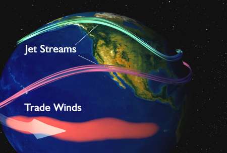
But every few years, the trade winds that blow from east to west weaken, allowing that warm water to slosh eastward and pile up along the equator. The warm water causes the air above it to warm and rise, fueling precipitation in the central Pacific and shifting atmospheric circulation patterns across the basin.
This phenomenon is called El Niño and can affect weather conditions around the world.
In its simplest definition, a strong El Niño occurs when mean sea surface temperatures in the equatorial Pacific Ocean are at least 1.5 degrees Celsius (2.7 degrees Fahrenheit) above normal. It is measured in a hypothetical field along the equator, roughly south of Hawaii, and is known as the Nino 3.4 index.
Source: Live Science